East Bay Wildfire Coalition of Governments
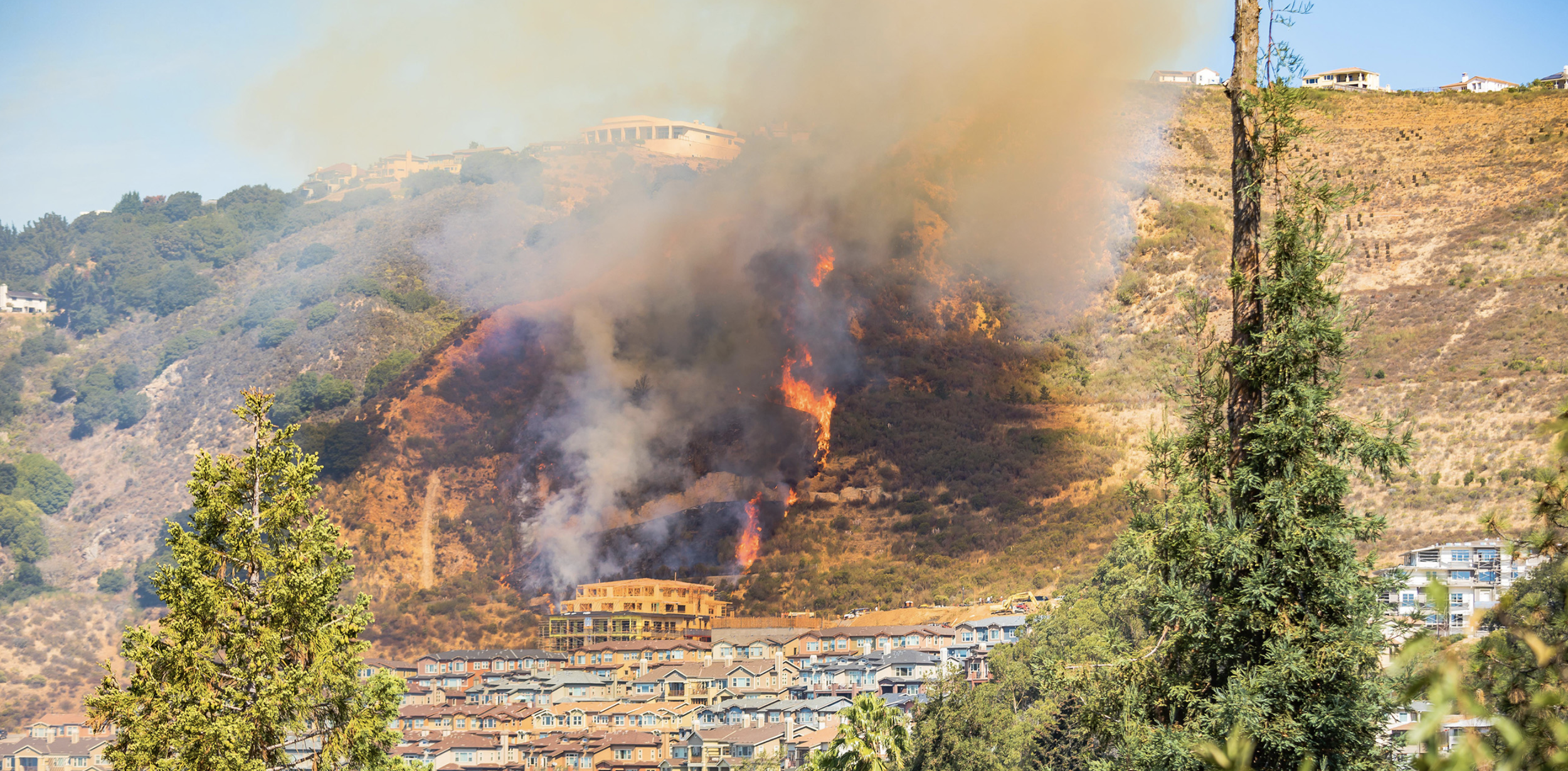
Photo credit: Julia Sumangil Photography
Welcome to the website for the East Bay Wildfire Coalition of Governments (EBWC). Come here for meeting notices and materials, background information, and updates.
NEW IN 2026:
First meeting of 2026 includes new Chair and Vice Chair, new communications and education campaign. Video
SPUR report on Bay Area Fire Mitigation Strategies. SPUR is a San Francisco Bay Area Planning, Policy and Urban Research Association
VIDEO: SPUR highlights EBWCG as good governance enhancing wildfire resilience
REPORT: State Senate Bill SB894 for low interest loans for home hardening investments
From the California Dept. of Insurance: Tips for residential insurance and letter in support of Zone Zero
ANNOUNCEMENTS:
Click here for EBWC Meeting Information and Documents.
Click here to download a one-page info sheet on the EBWC.
Click here for EBMUD’s Wildfire Preparedness page, which includes a hydrant map
Key press report on fire resilience: LATimes on Zone Zero
Who we are
| Member Jurisdiction | Represented by: |
|---|---|
| Alameda County | Supervisor Nikki Fortunato-Bas Fire Chief William McDonald |
| Contra Costa County | Supervisor John Gioia
Fire Chief Lewis Broschard |
| City of Berkeley | Councilmember Shoshana O'Keefe
Fire Chief David Sprague |
| City of El Cerrito | Councilmember Lisa Motoyama Fire Chief Eric Saylors |
| City of Hercules | Councilmember Alex Walker-Griffin |
| City of Oakland | Councilmember Janani Ramachandran (Chair) Fire Chief Damon Covington |
| City of Pinole | Councilmember Maureen Toms (Vice Chair) |
| City of Richmond | Councilmember Soheila Bana Fire Chief Aaron Osorio |
All member jurisdictions formally adopt and sign the Memorandum of Understanding for Coordination of Wildfire Prevention Activities to Protect the East Bay Hills in Alameda and Contra Costa Counties.
Each member appoints one elected official to sit on the EBWC Board. Fire Chiefs advise their respective elected officials and participate in EBWC meetings.
-
Regional agencies and organizations advise the EBWC and participate in meetings.
University of California at Berkeley
Lawrence Berkeley National Laboratory
East Bay Regional Parks District
East Bay Municipal Utility District
East Bay FireSafe Alliance
Diablo Firesafe Council
-
The EBWC covers western Alameda and Contra Costa Counties containing areas designated as High or Very High Fire Hazard Severity Zones by the California Department of Forestry and Fire Protection (CAL FIRE).
-
Recognizing that wildfire does not respect jurisdictional boundaries, the East Bay Wildfire Coalition of Governments (EBWC) is a regional consortium of elected officials representing cities, counties and fire districts committed to safeguarding our communities and natural landscapes in the East Bay Hills of the San Francisco Bay Area.
We support proactive, science-based, ecologically sound and data-driven approaches to resiliency. Through preparedness, community engagement, education, and collaboration, we support mitigating the increasing threat of cata-strophic wildfires due to the climate crisis.
-
Strengthen building and fire codes and adherence
Support science-driven regional vegetation management priorities
Advocate for local, county and state legislation
Support evacuation and response programs
Secure new funding for regional priorities
-
Education: Create community engagement program to inform property owners, and decision-makers, about the value of home hardening and defensible space including “zone zero”
Legislation: Support adoption of state, county and local ordinances to promote consistent region-wide risk reduction measures in wildfire hazard zones
Funding: Promote and support a regional assistance program for qualified homeowners to help establish ember-resistant zones within five feet of structures, or “zone zero”
-
Funding: Promote implementation of best practices for various vegetative types, raise funds for situational analyses, plans for a CEQA-compliant, ecologically-sound, region-wide vegetation management plan
Project management: Apply for grants, distribute funding and support activities
-
Work began in 2019 when a small group of East Bay community leaders concluded that wildfire prevention efforts could not be successful on a city-by-city or fire district basis alone. Volunteers from local organizations, including Oakland Firesafe and Claremont Canyon Conservancy, solicited political and community support, raising enough money to retain a professional consulting firm (Placeworks) and legal adviser (Hanson Bridgett) which drafted the Memorandum of Understanding (MOU).
On April 29th 2024, the EBWC convened for the first time. As of August 2024, 10 local governing bodies have joined the coalition. The EBWC now continues to meet on a regular basis (see the “Meetings” section for more details).
-
The EBWC members decided on a Memorandum of Understanding (MOU) to provide the legal basis for the jurisdictions to work together to accomplish agreed upon goals, in this case efforts to limit or prevent damage from future wildfires.
The MOU can be signed by counties (Alameda and Contra Costa), all cities and towns, and all fire districts with jurisdiction in the East Bay Hills.
BACKGROUND - What is the EBWC?
Meetings
All EBWC meetings are open to the public
UPCOMING MEETINGS
Wednesday, July 22nd at 9:00 AM Oakland City Hall, City Council Chambers: 1 Frank Ogawa Plaza, Oakland, 94612
Meeting Agenda
Meeting Agenda Packet
Meeting Video Recording
Marin Wildfire Prevention Authority Presentation
EBWC Strategic Communications Campaign Presentation
Richmond OES Evacuation Drill Presentation
Richmond WUI-Go! Evacuation Drill Presentation
SAVE THE DATES
Wednesday, September 23rd at 9:00 AM LOCATION TBD
November Meeting DATE/LOCATION TBD
PREVIOUS MEETINGS
Wednesday, May 27th at 9:00 AM El Cerrito City Hall: 10890 San Pablo Ave, El Cerrito 94530
March 25, 2026 (special location 2180 Milvia Street in Berkeley, in the Redwood Room)
October 22, 2025
September 24, 2025
July 23, 2025
April 16, 2025
Attachment 2: EBWC Strategic Framework One-pager (adopted November 2024, updated with new members)
Meeting recording (YouTube)
February 27, 2025
Presentation 2: EMBER: Effective Measures for Berkeley’s Ember Resilience
Attachment 4: Governor Newsom’s Executive Order regarding implementation of “zone zero”
Meeting Recording (YouTube)
Meeting 5: November 14, 2024
Meeting 4: October 21, 2024
Meeting 3: September 23, 2024
Agenda
Attachment 1: Strategic Framework
Attachment 2: EBWC Fee Structure
Attachment 3: Letter from AAA
Meeting Minutes
Meeting 2: July 8, 2024
Agenda
Attachment 1: regional fire service presentation
Attachment 2: Sierra Club and Native Plant Society presentation
Attachment 3: East Bay FireSafe Alliance presentation
Meeting minutes
Meeting 1: April 29, 2024
Agenda
Attachment 1: Ideas for the Wildfire Prevention Coordinating Group
Meeting minutes